Region Wachau


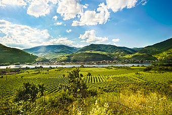
The Wachau is a 36 km-long water gap along the Danube. It arose because the Danube between Emmersdorf and Melk in the west and Stein and Mautern in the east separated the Dunkelsteinerwald from the Waldviertel and in some areas burrowed more than 700 metres deep into the heavily eroded mountain landscape of the Bohemian Massif.
Thanks to its mild climate and the varied vegetation and landscape, the Wachau has been an area of human settlement since the Stone Age. The best-known witness of this is the approx. 29,000 year-old, world-famous “Venus of Willendorf” figurine. It was found almost a century ago in the little town of Willendorf in the Upper Wachau during the construction of the Donauuferbahn railway.
Further evidence of this uninterrupted history of settlement is provided by the numerous, closely huddled and extraordinarily picturesque villages, market towns and cities strung out along the river – and sometimes in the side valleys as well – like pearls on a chain. While many places on the south bank date to the time of Roman colonisation, the north bank, which was Germanic during the Roman period, was gradually turned into arable land starting in the Middle Ages.
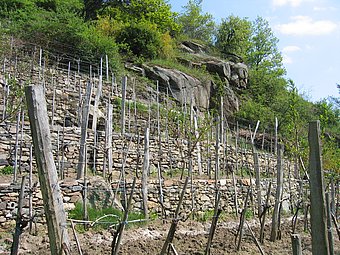
The most powerful proof of this are the countless dry stone wall terraces. Many of them are several hundred years old and enabled the cultivation of wine on the steep slopes, which were ideally suited to high-quality wine production due to their soils and the climatological conditions. This cultivation was mostly managed by the monasteries located further up the Danube. Many places in the Wachau therefore became part of Austria only centuries after their establishment.
With the radical secularisation of the German monasteries in 1803, many of the Wachau’s vintners were suddenly left to their own devices. Decades of decline followed. Only when the trend of taking holidays took hold at the end of the 19th century did people rediscover the Wachau – this time as an excursion and holiday destination. The special morbidity, the charm of the “old days” and the special light in this unique landscape held a particular appeal for artists. Numerous masterpieces from this time still bear witness to this spirit of optimism.
The new role of the Wachau as a tourism destination was supported at the beginning of the 20th century by the construction of the railway on the north bank and later by the construction of the two federal highways on the north and south banks. All are still deemed to be prime examples of the construction of landscape-sensitive transport routes.
Of major importance for the future of the landscape was the successful fight against the construction of a power plant on the Danube at Rührsdorf in the 1970s and 1980s. As a consequence of these events, the Wachau successfully applied for the European Diploma for Protected Areas of the Council of Europe and a UNESCO World Heritage Site. The future of the Wachau thus became a matter for the whole of humanity.
Since the beginning of the 21st century, the Wachau has been actively involved in delivering targeted improvements to the region’s living and economic conditions through regional development projects and at the same time taking appropriate measures to conserve and improve the substance of this unique landscape.

